Wysilab ships Instant Terra 2.5
Originally posted on 15 February 2021. Scroll down for news of the 2.5 update.
Wysilab has released Instant Terra 2.0, the next major version of its 3D landscape generation tool, adding a new toolset for animating terrain.
The release also adds a new system of size presets, making it possible to change the resolution of terrains after they have been generated without significantly affecting their characteristics.
A fast, lightweight procedural tool for generating terrains for real-time work
First released in 2018, Instant Terra is designed as a fast, lightweight tool for creating terrain complete with surface water features, particularly for games and real-time projects.
Workflow is primarily graph-based – the software includes nodes for generating terrain and mimicking the effects of different types of erosion – with the option to paint masks to control the effect of nodes.
The software imports DEM data or source images, and exports terrain as an FBX mesh or heightmap, supporting a range of common 2D image formats including OpenEXR.
Users work directly at the final resolution of a terrain, with changes displayed in a 3D preview in real time.
Animate terrain properties or colours and export the results to other 3D apps for rendering
The major feature in Instant Terra is the new animation toolset, revealed in a teaser video earlier this month.
It enables users to animate terrain properties, masks and colours via a timeline interface.
Each property being animated is shown on a separate animation track, and there are fairly standard options for adding, removing or copying keys, plus a basic range of interpolation types.
Once created, animations can be rendered from the Instant Terra viewport as videos or series of still images, or exported as a series of OBJ, FBX or Alembic meshes for rendering in other 3D software.
New terrain Size preset node helps to upscale terrain after creation
Other key changes in Instant Terra 2.0 include a new system of terrain size presets.
A new Size preset node specifies the dimensions used by generator nodes in metres or points, and can be automatically referenced by all terrain generator and mask generator nodes.
Adding the Size preset node to a project graph enables users to change the dimensions of terrain – for example, if higher-resolution output is required – without significantly changing its form.
The release also introduces a new Mask from convexity node, which automatically generates masks based on the curvature of terain: for example, to separate hilltops from valley floors.
UI changes include a new Welcome screen with links to project templates and recently used files.
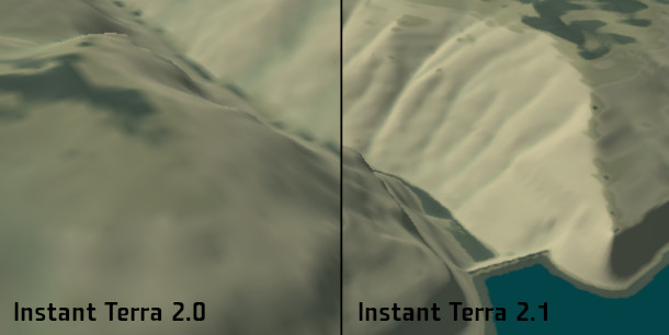
Updated 5 April 2021: Instant Terra 2.1 is shipping. The update adds Mapbox as one of the data sources for Instant Terra’s World browser, in addition to the OpenTopography data set.
The new data source makes it possible to download elevation data for parts of the real world with a “resolution more than 50 times better than before”, as shown in the image above.
The Mapbox data is commercial, but a free subscription lets you process a reasonable land area per month.
Other changes include two new Warp and four new Blur nodes for processing terrain, masks or colour maps; and the new Animation window gets a repetitive paste option for creating looping animations.
Updated 6 May 2021: Instant Terra 2.2 is shipping.
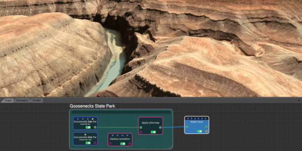
The update makes it possible to download satellite imagery along with elevation data, for texturing terrain, and adds new Brightness & Contrast and Gamma correction nodes for adjusting the result.
Updated 8 July 2021: Instant Terra 2.3 is shipping.
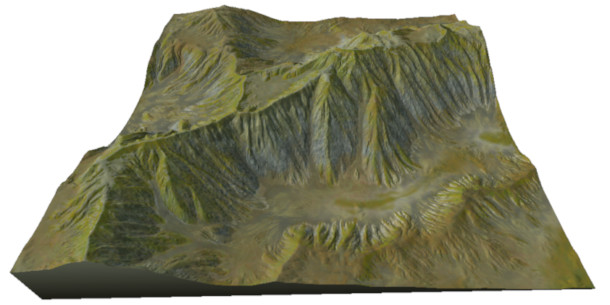
The update adds three new nodes for simulating terrain erosion: thermal erosion for river banks, multi-scale erosion for eroding terrain more deeply than existing erosion modes, and a new mountain aging system.
Real-world geographic data from source files is now preserved when exporting terrain in TIFF or ASC format.
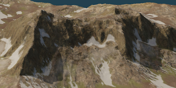
Updated 2 November 2021: Instant Terra 2.4 is shipping. The update adds shadows on 3D terrain.
There are also three new nodes for adding PBR materials to terrain. The Simple Material and Material nodes position materials based on altitude and slope; Advanced Material positions them based on masks.
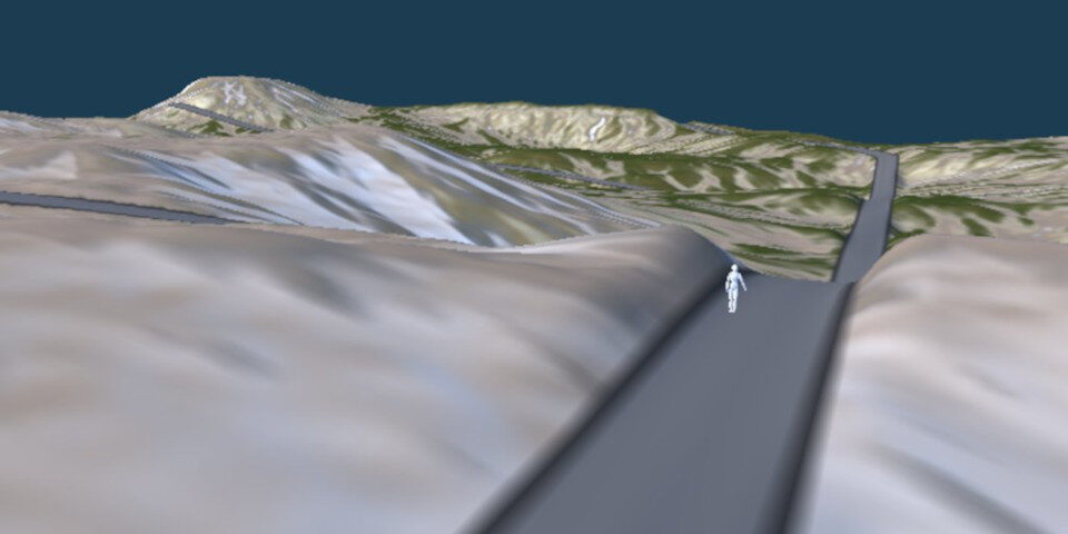
Updated 14 March 2022: Instant Terra 2.5 is shipping.
The update adds a new system for adding roads, with the Road node automatically deforming terrain to create a horizontal road surface, and new Line and Arc mask generators for laying out road networks.
Pricing and system requirements
Instant Terra 2.5 is available for Windows 7+ only. A perpetual licence costs $149 for 8K export; $199 for unlimited resolution.
There is also a Pro edition aimed at larger studios, which includes features geared towards generating very large terrains, multi-file export, and a Python API. It is priced on enquiry.
Read an overview of the new features in Instant Terra 2 on the product blog
Read a full list of new features in Instant Terra 2 in the online documentation