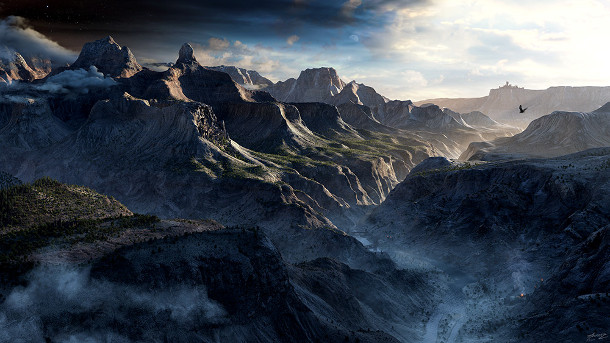
Gnomon releases Creating Terrains with Satellite Data
The Gnomon Workshop has released Creating Terrains with Satellite Data, a new two-part tutorial series on creating photorealistic 3D terrain using freely available satellite data.
Recorded by Gnomon founder Alex Alvarez, and clocking in a shade under 14 hours, the two videos explain how to create detailed, art-directable environments in Maya and Photoshop, augmented by ZBrush and Mari.
Scouting, processing and rendering satellite data
Volume 1 of the series begins with location scouting with Google Earth, then downloading the DEM elevation data from the U.S. Geological Survey, using Global Mapper to stitch the tiled data for import into Maya.
After removing shadows in Photoshop, Alvarez explains how to set up displacements, rendering with the mental ray’s physical sun and sky system, and setting up the textures required using mia_material.
He also explores how to use multiple UV regions with multiple tiled textures on a single plane, allowing for the creation of the much larger terrains often needed for fly-through animations.
Photoshop plugin Filter Forge is used to create procedural bump maps to improve high-frequency detail.

Volume 2 of the series covers more advanced techniques for refining and up-resing digital terrain.
Advanced techniques for up-resing and art directing terrain
Volume 2 of the series, which lasts just under six hours, focuses on techniques that enable artists to selectively ‘up-res’ regions of the terrain, using ZBrush to sculpt extra detail.
New geometry is created from the initial DEM file, topologised, UV-ed, then sculpted using ZBrush’s HD Geometry, using procedural rock textures as Alphas to quickly generate rock and cliff details.
Alvarez also demonstrates an alternate approach for using DEMs directly in ZBrush, as well as how to use Decimation Master and third-party tool xNormal to generate high-quality results.
ZBrush work complete, new satellite photos are acquired using Google Earth Pro to generate 8k and 16k textures, cleaned up in Mari, and projected onto the new terrain geometry in Maya.
As an alternative to the convenient, but less controllable, physical sun workflow shown in Volume 1, Alvarez outlines an HDR workflow, combined with direct lighting; and atmospheric effects such as haze and fog.
The video concludes by rendering the various passes required and combining them in Photoshop to tune the final look of the image.
About the artist
Alex Alvarez is the founder and president of the Gnomon School of Visual Effects in Hollywood and The Gnomon Workshop. He was a creature development artist on Avatar, Star Trek, Green Lantern and Prometheus.
Both volumes of Creating Terrains with Satellite Data are available from The Gnomon Workshop’s online store as digital downloads, price $69, with DVD releases to follow.
Buy Creating Terrains with Satellite Data: Vol. 1 from The Gnomon Workshop’s online store
Buy Creating Terrains with Satellite Data: Vol. 2 from The Gnomon Workshop’s online store
Full disclosure: CG Channel is owned by the Gnomon School of Visual Effects.
