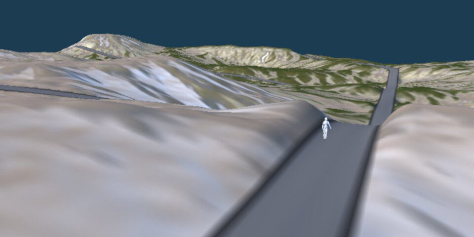
Wysilab ships Instant Terra 2.5
Terrain generator for games and real-time work gets new system for creating roads, deforming the land surface automatically to match.
Monday, March 14th, 2022
Terrain generator for games and real-time work gets new system for creating roads, deforming the land surface automatically to match.
Monday, March 14th, 2022

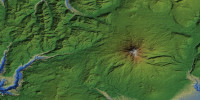
Popular plugin turns online DEM data into 3D terrain inside 3ds Max - now to 30m resolution worldwide.
Tuesday, March 16th, 2021

Check out the new features in the photogrammetry tool, including faster depth map generation and integration with laser scan data.
Friday, January 8th, 2021
Neat 'open use' tool exports 3D terrains or heightmaps to DCC tools and game engines, at up to 65K resolution.
Friday, January 10th, 2020

Popular image-based modelling tool PhotoScan gets a free update speeding up 3D mesh generation - and changing the product name.
Tuesday, January 8th, 2019

Image-based modelling software gets new model and point cloud viewing capabilities, plus beta support for synchronised shooting.
Tuesday, August 9th, 2016

New two-tutorial set provides comprehensive guide to creating detailed, art-directable 3D terrain.
Monday, April 28th, 2014

New instancing features, plus the option to use satellite photos to generate instant textured terrain.
Tuesday, February 4th, 2014