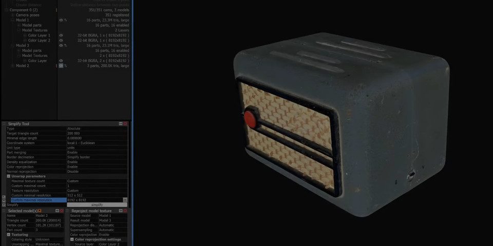
Epic Games releases RealityCapture 1.5
Big update to the photogrammetry app adds USD export and new options aimed at games and VFX. Free to indie artists and studios.
Friday, November 22nd, 2024
Big update to the photogrammetry app adds USD export and new options aimed at games and VFX. Free to indie artists and studios.
Friday, November 22nd, 2024

Fun new app turns elevation data into 3D terrain and renders path-traced stills or turntable animations.
Sunday, October 20th, 2019
Big update to image-based modelling tool improves speed and accuracy of mesh generation, adds new camera calibration manger.
Wednesday, July 18th, 2018